


Byron Bay News
Award nominations roll in for Byron bus interchange

Award nominations roll in for Byron bus interchange
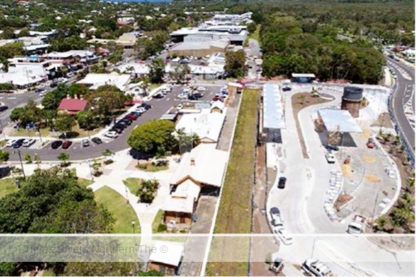
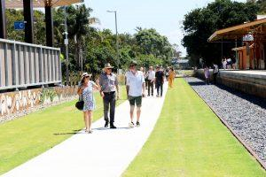
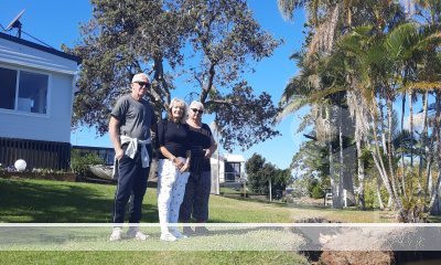
Byron Bay’s centrally located bus interchange has won a string of prestigious awards in recent months and this week received a nomination for the Premier’s “Putting Citizens at the Centre” award.
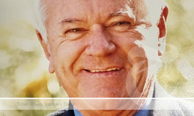
“This precinct was the first to roll out from the Byron Masterplan and delivers significant outcomes in terms of removing heavy traffic from the centre, improving pedestrian and cycleways, creating beautiful new community spaces and celebrating our town’s heritage,” Byron Shire Mayor, Michael Lyon said.
“There is always uncertainty and scepticism when we talk about change in Byron, but we are thrilled that the feedback we’re getting is that these projects have given the community confidence that Council can sensitively and respectfully improve the way the town centre looks and feels, and how it’s used,” Mayor Lyon said.
That was always the aim and we feel like it’s been achieved in this precinct,” Cr Lyon said.
In addition to the Premier’s recent “Putting Citizens at the Centre” award nomination, in June the Byron bus interchange received Australian Institute of Landscape Architecture Awards (AILA) for:
- NSW Excellence Award in Infrastructure
- Regional Achievement Award for Northern NSW
The interchange was a partnership project delivered by Transport for NSW and Council as part of the Byron rail precinct upgrades completed in 2021.
The vision was to transform a disused and unsafe area of town into a place where community could gather, that could be accessed safely and easily.
The area had consistently received negative community feedback due to illegal camping, rubbish dumping, community safety and flooding.
 The project teams worked together to address these issues while celebrating the site’s rail heritage and link it with significant local Aboriginal heritage.
The old Green Frog jetty engine, which chugged around Byron Bay from 1923 to 1983, has been restored and will be permanently housed on the rail platform, a reminder that long before it was a tourist destination, it was a working-class town with a meatworks, butter factory, whaling station and sand mining operation.
The planning, design and delivery of these projects involved a collaborative process with a broad range of stakeholders including Transport for NSW. Sydney Trains, Heritage NSW, design teams, engineers, local building contractors and the local community through the Byron Masterplan Guidance Group, Byron Historical Society and the local Arakwal people.
“We will soon see the next round of Masterplan projects roll out, with construction of the new skate park at Sandhills beginning in August and the proposal to move the markets to the centre of town later in the year,” Mayor Lyon said.
“We know there’s both excitement and nerves around these next projects too and hope the community will continue to work with us to deal with any issues as they arise and hopefully celebrate a great result at the end,” he said


BROADWATER FERRY

Government adds to cost of living as buybacks begin

Farm Safety Shouldn’t Cost an Arm or a Leg

The annual Bizzy and Jomanda Brahman sale will be held Saturday 7th September 2024, 11am at the Grafton Saleyards.

Biosecurity System Reaps Rewards of Sensible Cost Recovery Reform

Are Your Workers in Safe Hands? The Critical Role of First Aid Training in Agriculture

A NEW TWEED HEADS

Toyota Supra: Get Ready For A Fully Electric Version In 2025

Northern Rivers Local Health District COVID-19 update

Northern Rivers COVID-19 update

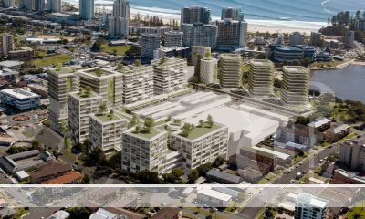
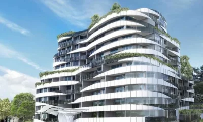
Fears proposed residential tower will ‘obliterate’ Tweed neighbourhood’s amenity and charm

COVID-19 Vaccination Clinic now open at Lismore Square


Two teens charged with property offences in Tamworth and Hunterview – Operation Regional Mongoose
Two teens charged with property offences in Tamworth and Hunterview – Operation Regional Mongoose Thursday, 25 July 2024 01:34:07 PM...
Two men arrested following Bondi police operation and pursuit
Two men arrested following Bondi police operation and pursuit Thursday, 25 July 2024 01:31:18 PM Two men have been arrested...
Man charged following incident at Miranda shopping centre – CTST Command
Man charged following incident at Miranda shopping centre – CTST Command Thursday, 25 July 2024 12:21:33 PM A man has...
-
 Tweed Shire News2 years ago
A NEW TWEED HEADS
-
 Motoring News1 year ago
Toyota Supra: Get Ready For A Fully Electric Version In 2025
-
 COVID-19 Northern Rivers News3 years ago
Northern Rivers Local Health District COVID-19 update
-
 COVID-19 Northern Rivers News3 years ago
Northern Rivers COVID-19 update
-
 Northern Rivers Local News3 years ago
Fears proposed residential tower will ‘obliterate’ Tweed neighbourhood’s amenity and charm
-
 Health News3 years ago
COVID-19 Vaccination Clinic now open at Lismore Square
-

 COVID-19 Northern Rivers News3 years ago
Lismore Family Medical Practice employee close contact
-
 NSW Breaking News3 years ago
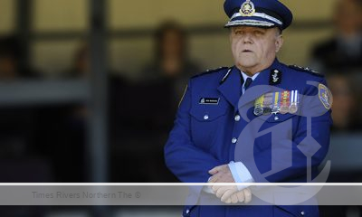
Vale: Former NSW prison boss Ron Woodham